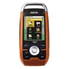
Detail Magellan Triton 1500
Features :
* 2.7" color touch screen control - The latest touch-screen technology is built in to the large brilliant color display. Control navigation and advanced features with a touch
* Amazing ease-of-use - Reinventing handheld GPS™, simple menus, instant access buttons, intuitive keypad and crystal clear graphics let you navigate without the need for a Ph.D.
* Voice recorder - Microphone and speaker enable you to record audio notes for waypoints to share with friends and family or easily find your way back next time
* Flashlight - Light your way with a powerful LED flashlight. Low power consumption helps maximize battery life.
* SD-card expansion - Use your own SD memory cards to upload unlimited detailed maps
* Built-in maps - Basemap of the 48 contiguous United States, Alaska, and Canada (major highways, city centers, bodies of water and more) plus worldwide geographic boundaries
* Add detailed maps - Upload optional marine cartography, topographic maps, and more, including the highly-detailed and feature-packed National Geographic TOPO! State series and Weekend Explorer 3D maps to your OWN SD cards
* Compass screen - See your direction of travel, distance and position of destination, heading, bearing, speed and more on the beautiful graphic compass
* 3-meter accuracy - SiRFstarIII™ chipset and integrated multidirectional antennae offer superior GPS accuracy using the Wide Area Augmentation System (WAAS)
* Digital music player - Upload your digital music to the available memory or own SD card and enjoy a customized soundtrack as you explore. Plug in any standard headphones for clear private listening
* External antenna connector - Simply plug in an external antenna in your boat or off-road vehicle for enhanced GPS signal reception
* Audio jack - Plug in any standard 1/8" headphones to enjoy clear private listening of your digital music, voice notes and other recordings
PHYSICAL:
Case Rubber armored impact-resistant plastic, water-resistant seal, IPX-7
Pre-Loaded Maps Built-in basemap of Contiguous U.S., Alaska, Canada and Worldwide Geographic Boundaries
Size 5.75" x 2.5" x 1.13"
Weight 8.0 oz (227 g) - w/ battery
Screen Size 2.7" (6.86 cm) diagonal, QVGA (240X320) resolution and touch screen (LED backlit)
SD RAM SD Card
Memory available for map storage Secure Digital (SD) Card
Antenna Type Built-in multidirectional patch (or optional external antenna)
Keypad Nine direct-access keys
Operating Range 14 to 140°F (-10 to 60°C)
PERFORMANCE
GPS SiRF Star III™ 20 channels, WAAS/EGNOS
Acquisition Time Hot: 20 seconds, Cold: 60 seconds, Initial: 2 minutes
Update Rate Once per second
GPS Accuracy 3 to 5 meters (10 - 16 feet) - WAAS/EGNOS, < 7 meters (15 feet) - GPS only
Languages English, French, German, Dutch, Italian, Spanish, Danish, Norwegian, Swedish, Finnish, Portuguese.
Coordinate Systems Latitude/Longitude, UTM, OSGB, Irish, Swiss, Swedish, Finnish, German, French, USNG, MGRS, Indian, Dutch.
POWER
Source Two AA Batteries (included)
Battery Life 10 hours
Tampilkan Lebih Banyak